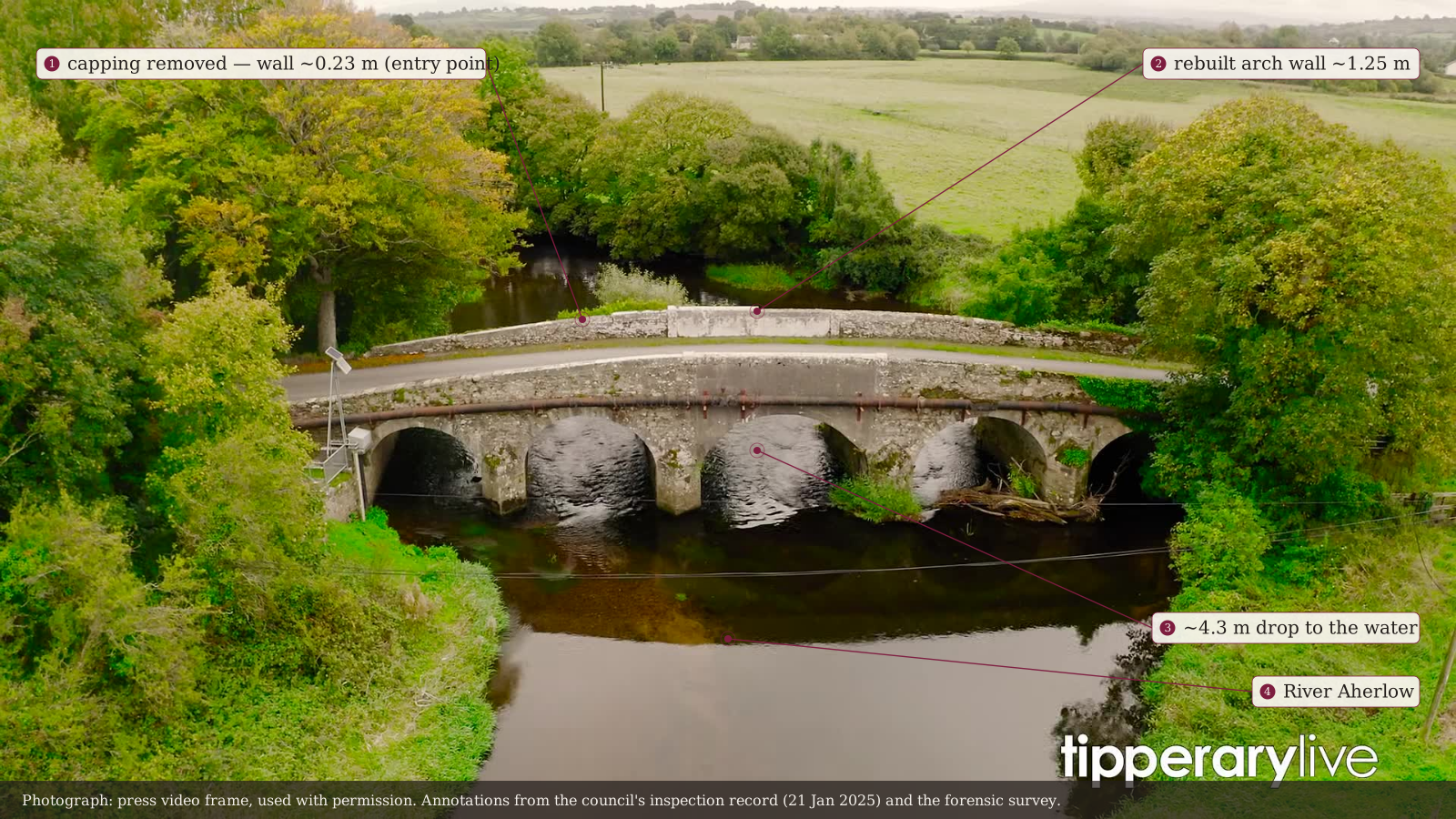
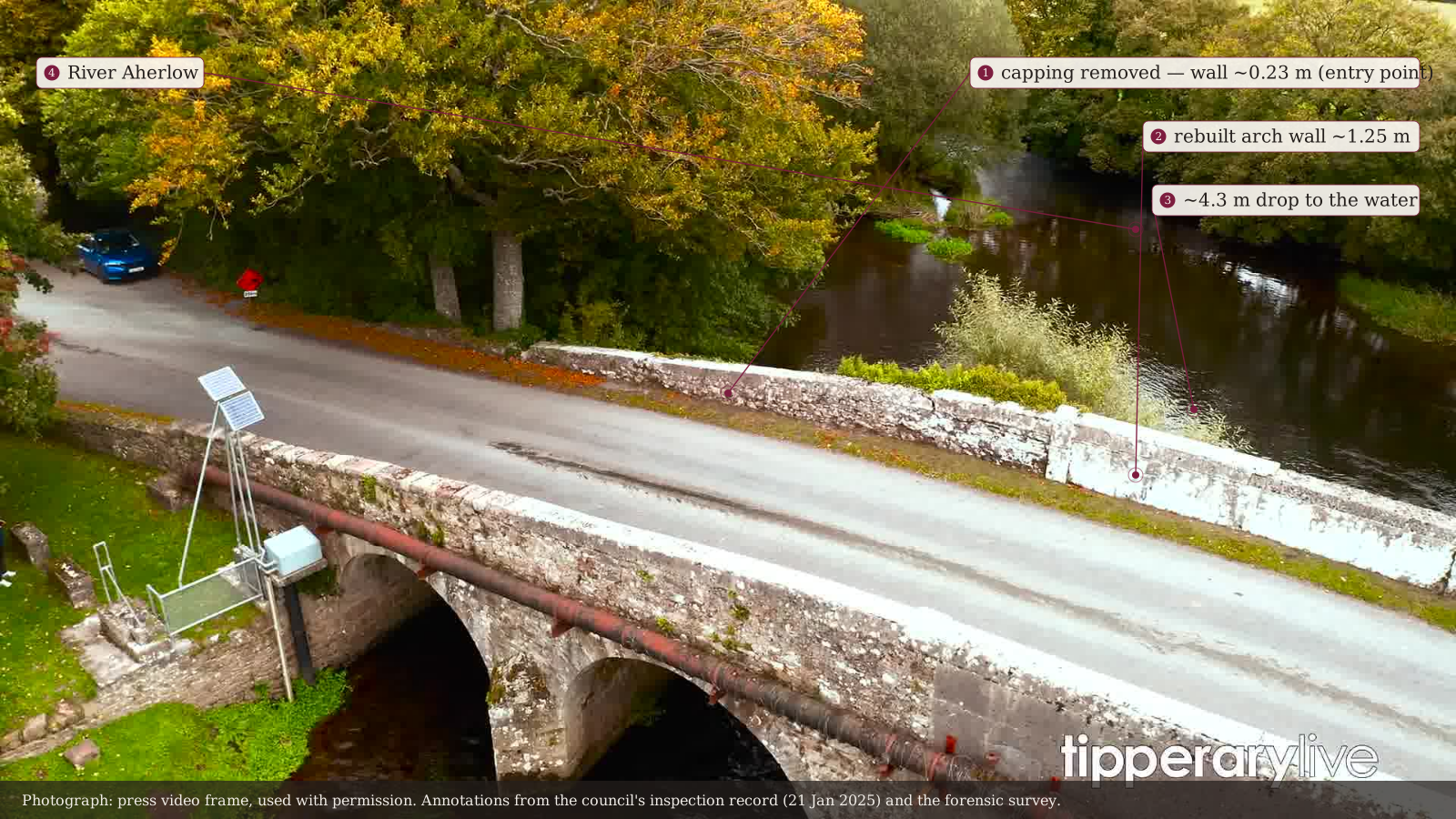
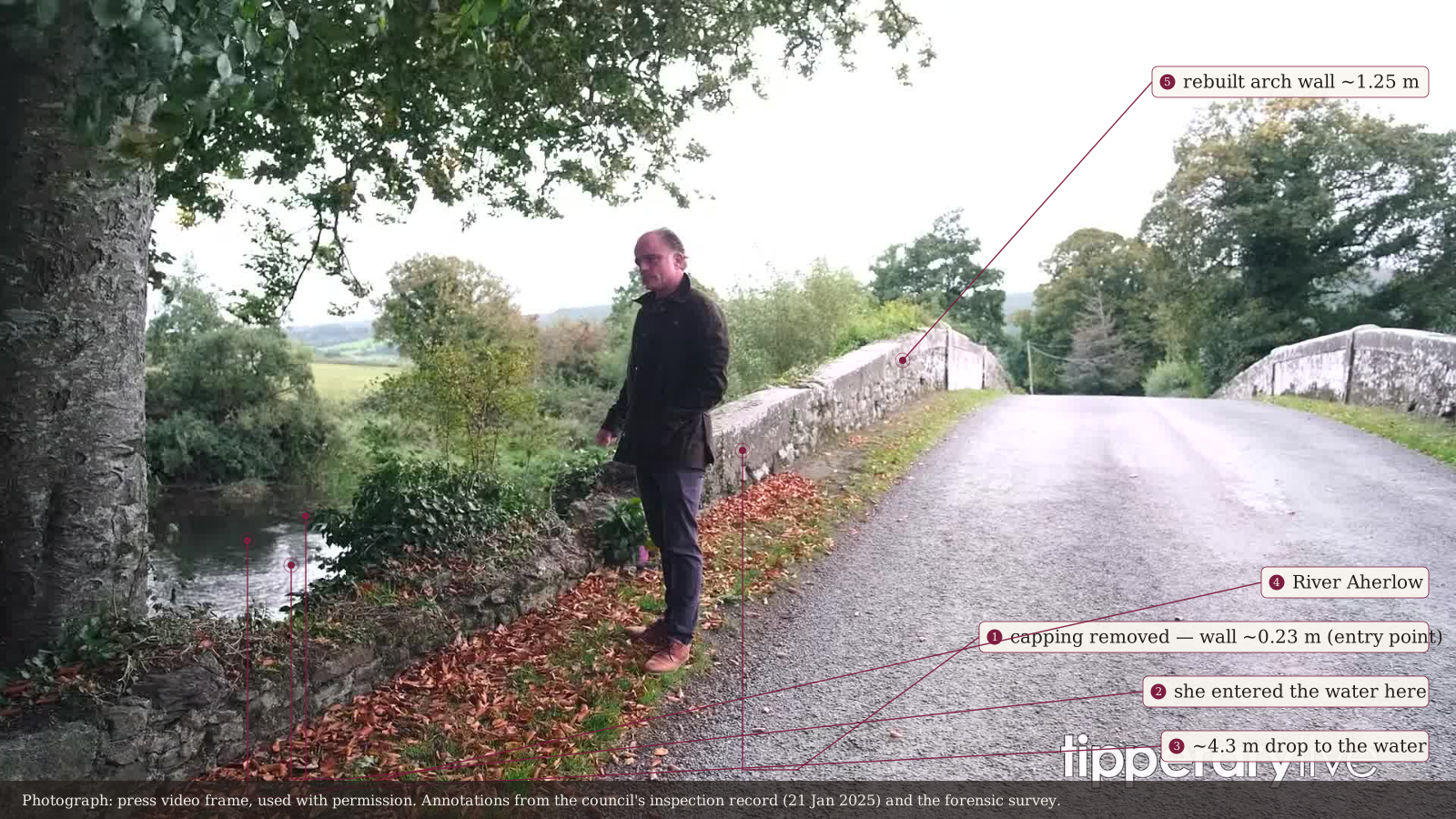
One point on one bend, drawn to scale from the recorded measurements — the wall that should have stood at 1.25 metres, the 0.23-metre remnant where the capping was removed, and the drop beyond it.
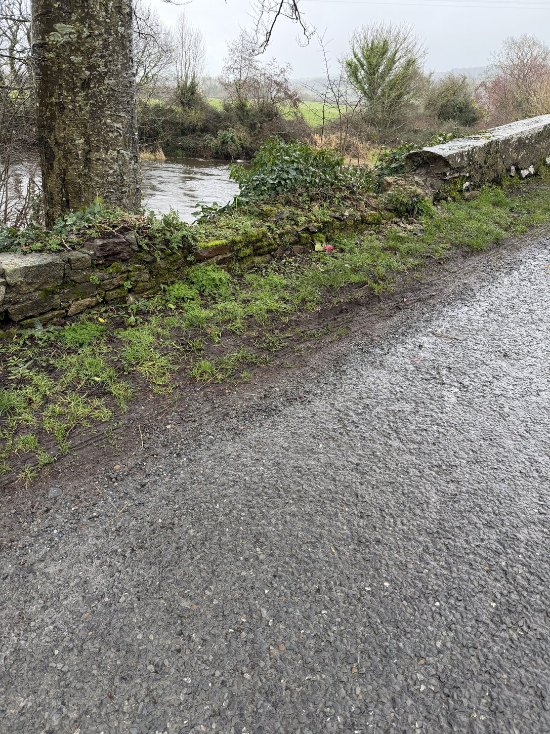
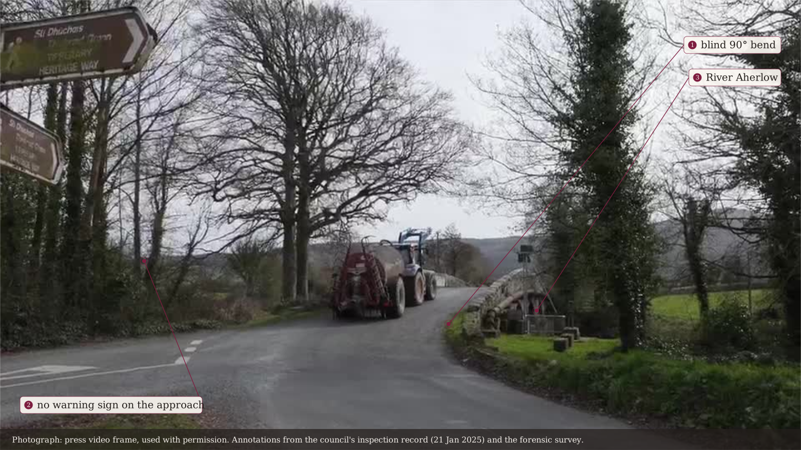
The stretch of wall where the capping was removed, as the family photographed it. Family photograph, February 2026.The bridge from the air — the rebuilt arch wall at ~1.25 m, the lowered stretch where the capping was removed, and the ~4.3 m drop to the River Aherlow. Press video frame, used with permission; annotations from the council's inspection record (21 Jan 2025) and the forensic survey.The deck from above — the low wall and the rebuilt 1.25 m parapet side by side, the water directly beyond. Press video frame, used with permission; annotations as above.Human scale at the entry point — the wall at about 0.23 m, and where she entered the water. Press video frame, used with permission; annotations as above.The blind 90° bend, with no warning sign on the approach. Press video frame, used with permission; annotations as above.
What each figure is
1.25 m — the height the parapet should have stood.
0.23 m — at the point of impact: capping “partly removed”, a 5 m length collapsed. TCC engineering inspection, 21 Jan 2025.
~4.3 m — the drop to the River Aherlow. DWA forensic survey, May 2025.
60 km/h — posted limit, cut from 80 km/h on 7 February 2025 — eleven weeks before. TCC PMS record.
Within the limit; did not swerve. Garda review.
Illustrative, drawn to the recorded measurements; states no fault or causation.
Last updated 2026-09-07. This is a living record — findings are added as dated entries and prior versions remain visible.